Signup for weekly updates on new printable items!
100% Privacy Guaranteed! ![]()
US Map- Connecticut Counties with Selected Cities and Towns
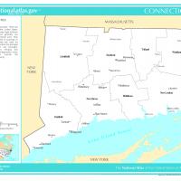
This map displays Connecticut's counties with selected cities and maps that are most populated. The state relatively small, borders New York to the west and south, Massachusetts to the north, and Rhode Island to the east. Print this map in a standard 8.5"x11" landscape format.