Signup for weekly updates on new printable items!
100% Privacy Guaranteed! ![]()
US Map- Landsat Satellite
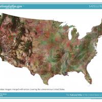
Use this colorful mosaic of Landsat satellite map to study the US agriculture, geology, forests, and more. This map includes terrain information, land cover characteristics and waterbodies. This map is fit for an 8.5"x11" paper.